Moving towards 3D Wisdom-the Ministry of the Interior holds a conference, industry, government and school gathering exchange.
Moving towards 3D Wisdom-the Ministry of the Interior holds a conference, industry, government and school gathering exchange.
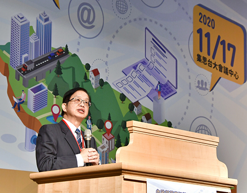
The Ministry of the Interior held the "Ministry of the Interior implementation of the Smart Land Plan and Space Mapping Technology presentation meeting" yesterday (17). Vice Secretary Qiu Changyue presided over the opening ceremony, Vice Secretary Qiu Changyue said,-3D national base map has been launched this month, 20-meter grid DTM (numerical terrain model) data has been officially released, and the Construction Department has established a national pipeline database covering an area of 462000 hectares, which is integrated with the data of the national base map. It is hoped that through industry-government-university-research exchanges, continuous improvement in related work will not only contribute to the development of the self-driving industry, but also move towards 3D wisdom.
Vice Secretary Qiu Changyue pointed out that in order to promote wisdom, the Ministry of the Interior has completed a number of achievements since 105 years. In addition to the continuous construction of basic land data in the past, the 3D national base map was also officially released in November this year. Start the online service of "Multi-dimensional National Spatial Information Service platform" In order to enrich the connotation of the national base map, but also continue to update the national numerical terrain model data, on the 17th officially released the "2020 Taiwan and some outlying islands 20-meter grid DTM data" for public use.
The Ministry of the Interior said that in order to promote the exchange of Land Information system (NGIS) results, the event took "Cross-domain sharing X decision upgrading" as the theme, combined with the four major themes of "DTM (numerical terrain Model) Open data and value-added Application", "Map and Capital Integration, Circulation and Application", "3D National Base Map Achievement Application" and "Spatial surveying and Mapping Technology Achievement publication". More than 600people signed up to participate. It is expected that through this presentation, through the exchange of industry, university and research circles, we can improve the application and industrial development of 3D map capital in China, and deepen the intelligent decision-making assisted by spatial data.

Qiu Changyue, Deputy Secretary of the Ministry of the Interior of ▲, was present to deliver a speech.
- Prev

In the autumn, the army insects are raging, and the drug institute launches a new weapon pheromone! Laws and regulations will not be listed until next year, and farmers can't wait.
In the autumn, the army insects are raging, and the drug institute launches a new weapon pheromone! Laws and regulations will not be listed until next year, and farmers can't wait.
- Next

Fishery and electricity symbiosis and rapid march, the first area to expand the territory to Gaoping 1289 hectares, fishermen's opinions are divided.
Fishery and electricity symbiosis and rapid march, the first area to expand the territory to Gaoping 1289 hectares, fishermen's opinions are divided.
Related
- A course of planting techniques and methods on how to grow carrots
- How to plant the latest tulips?
- Is it better to pick tea in the morning or in the afternoon? When is the best time for tea to be picked? what is the third or fifth tea?
- Launch Yuanxiao Happy combination Haocha + Tea Yuan healthy Taste
- Penghu Tourism "Fireworks 20 Parade with You"
- 2022 West Lake Happiness holds "Digital Revitalization Voucher" and draws iphone13 and laptop.
- Banqiao Fuzhou social houses are designed to change start-up combined with police elimination to create a safe and livable environment
- The convenient measure of "mechanical weeding" in Xinbei has been abused and the Agriculture Bureau has imposed heavy penalties on the illegal land consolidation.
- Changgeng University Joins Hands with Four Memory Factories to Rescue Memory Talent Shortage
- The list of Taiwan's top 100 MVP managers is listed by the Director-General of the Farmers' Association of Sanxia District.

