For the first time in Taiwan! The drone quickly surveyed the disaster. Kaohsiung Banner Mei damaged 380 hectares of rice fields in one day and could be harvested the next day.
Share
Yesterday (20), the front of Meiyu went all the way to the south. between 3: 00 and 4: 00 in the afternoon, there were rare strong winds and showers in the Chimei area of Kaohsiung, which not only caused the collapse of large urban billboards and injured motorcyclists, but also caused serious lodging of rice during the harvest period. the Council of Agriculture roughly estimated that the damage area was at least 380 hectares.
Once mature rice has not yet been harvested, it is easy to sprout due to soaking in water and high temperature. in the past, in order to "preserve the site" for disaster exploration, it could not be harvested, and when the harvest was finished, almost all the rice was scrapped. Chen Jizhong, chairman of the Council of Agriculture of the Executive Yuan, personally went to Meinung this (21) afternoon to care about the disaster and announced that drones would be deployed for the first time tomorrow (22) to investigate the disaster, which could be completed on the same day.
He stressed that "the farmers only need to apply, and the supporting materials will be handed over to the drones for processing." as long as the farmers complete the declaration tomorrow, they can immediately carry out the post-disaster harvest the day after tomorrow, which makes the farmers present and the district office personnel breathe a sigh of relief.
News background: in the past, disaster survey was carried out by manpower. Taking 300 hectares and six disaster surveyors as an example, it took at least three working days. Today, the drone was tested on the site for the media to shoot. The result can be taken within 15 minutes. Complete the aerial photos of 80 hectares and 300 clear photos, and quickly complete the interpretation of rice area, area and corresponding farmers.


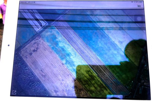
The two green areas on the screen are paddy fields and the dark ones are lodging areas. In response to disaster investigation, its accuracy and efficiency are indeed higher than those of manual workers (Photography / Li Huiyi)
- Prev

For the first time in Taiwan! The drone quickly surveyed the disaster. 380 hectares of rice fields damaged by Qimei were photographed in one day and harvested the next day.
For the first time in Taiwan! The drone quickly surveyed the disaster. 380 hectares of rice fields damaged by Qimei were photographed in one day and harvested the next day.
- Next

Taitung Environmental Protection Bureau: the lotus is in full bloom and the birds are beautiful except garbage.
The Taiping Creek constructed Wetland, located at the mouth of Taiping River in Taitung City, is a good place for hospitals, schools, and communities to rest. People often run, ride bicycles and take a walk on the banks of the wetlands. Recently, Taiping Creek has a rich flock of birds.
Related
- A course of planting techniques and methods on how to grow carrots
- How to plant the latest tulips?
- Is it better to pick tea in the morning or in the afternoon? When is the best time for tea to be picked? what is the third or fifth tea?
- Launch Yuanxiao Happy combination Haocha + Tea Yuan healthy Taste
- Penghu Tourism "Fireworks 20 Parade with You"
- 2022 West Lake Happiness holds "Digital Revitalization Voucher" and draws iphone13 and laptop.
- Banqiao Fuzhou social houses are designed to change start-up combined with police elimination to create a safe and livable environment
- The convenient measure of "mechanical weeding" in Xinbei has been abused and the Agriculture Bureau has imposed heavy penalties on the illegal land consolidation.
- Changgeng University Joins Hands with Four Memory Factories to Rescue Memory Talent Shortage
- The list of Taiwan's top 100 MVP managers is listed by the Director-General of the Farmers' Association of Sanxia District.

